
NOAA REQUESTS YOUR COMMENTS ON THE NATIONAL HURRICANE CENTER’S TROPICAL WAVE ANALYSIS
NOAA REQUESTS YOUR COMMENTS ON THE NATIONAL HURRICANE CENTER’S TROPICAL WAVE ANALYSIS
The NOAA/NWS/NCEP/Ocean and Tsunami Center is requesting your comments about the Tropical Wave Analysis currently provided from Miami at the National Hurricane Center’s Tropical Analysis and Forecast Branch.
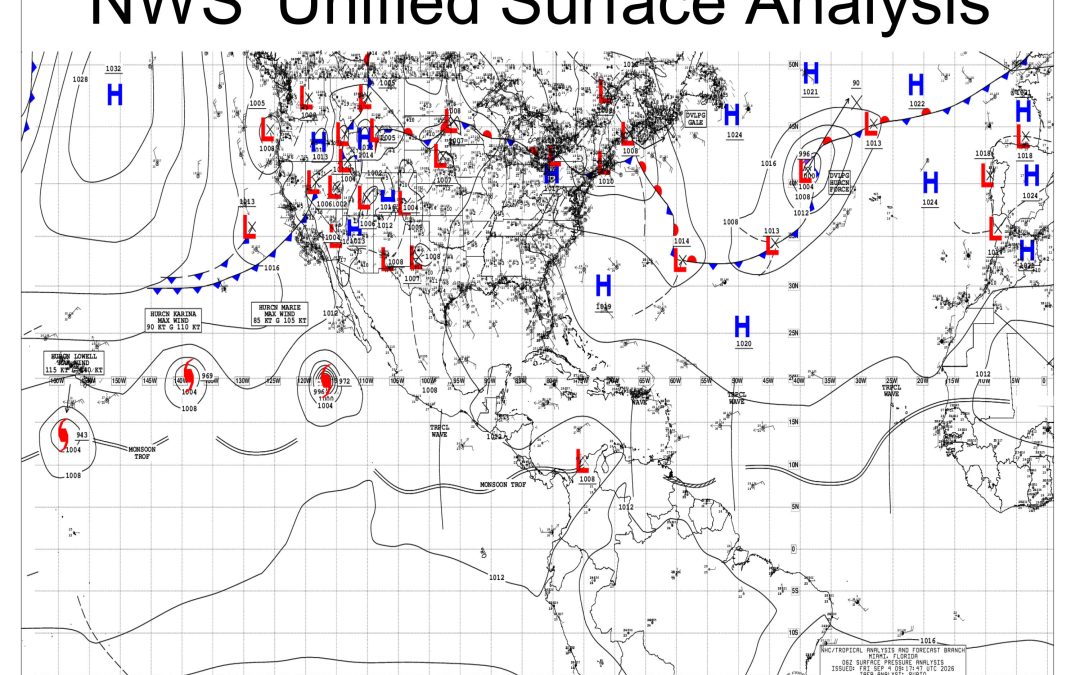
Currently, the center depicts “Tropical Waves” on its Unified Surface Analysis every six hours during the May to November time frame.
All Tropical Waves are currently depicted the same way, regardless of actual surface conditions. All are shown to have a trough axis on the map.
Some are strong waves with a well-defined surface wind shift, near-gale trades on the north side of the wave, a few millibar pressure drop, and numerous thunderstorms.
While others have no surface wind shift, no strong winds, negligible pressure drop, and no thunderstorms. (See visual posted on bridgedeck.org for an example of both.)
These weak Tropical Waves—which comprise about half or more of the systems depicted —are only detectable at the 700 mb level in the atmosphere (about 2 miles/3 kilometers above the ocean).
NOAA is soliciting your feedback on this analysis and how it might be improved.
Three options are being considered:
1. Continue with existing practice, or
2. Only show on Unified Surface Analysis those waves with significant surface component, or
3. Only show on Unified Surface Analysis those waves with significant surface component AND develop a new “Tropical Wave Only” graphical product
Any comments that you would like to provide as a mariner would be appreciated.
Please send your comments to:
Chris Landsea Chief, Science and Mission Integration Division NOAA/NWS/NCEP/Ocean and Tsunami Center
Chris.Landsea@noaa.gov
Related Posts

Wheelhouse Weekly, Jan. 30, 2024
Volume 30… Number 5, January 30, 2024 STORIES COVERED In This Issue: Maersk Suspends U.S.-Flag Red Sea Transits After Houthis Target MAERSK DETROIT and MAERSK CHESAPEAKE TRANSCOM Pledges To Increase Communications To Protect Mariners and Ships Indian Navy Helps Crew Extinguish Fire After Missile Strike ALSO: ITF Backs Strikes by Argentina’s Unions Over Anti-Worker Policies […]

MM&P Summer 2025 Magazine ONLINE!
Please click here to view a PDF version of our Summer 2025 magazine, The Master, Mate & Pilot.

Columbia River Bar Pilots Seeking Applicants
APPLY NOW! COLUMBIA RIVER BAR PILOTS SEEKING APPLICANTS: DEADLINE MARCH 15! The Columbia River Bar Pilots are actively seeking applicants to fill expected vacancies. Applicants must have at least one year of sea time as Master on commercial ships over 5,000 GT and two years of sea time. The Pilots are an equal opportunity organization […]